ShulMap: map every shul — and find where you can live within walking distance
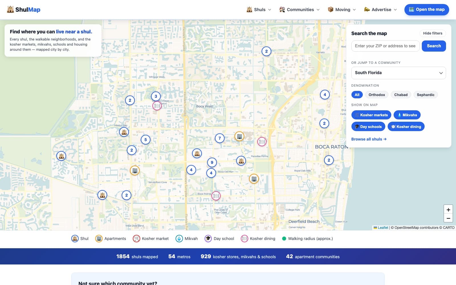
We designed and built an interactive mapping platform that charts shuls, kosher markets, mikvahs, and schools across North America — with walking-radius overlays that show observant families exactly where they can live.
- 1,850+
- shuls mapped
- 54
- metros, 24 states + Canada
- 929+
- kosher markets, mikvahs & schools
Where they started.
For observant Jewish families, where you live is bound by where you can walk on Shabbat — within range of a shul, and ideally near kosher shopping, a mikvah, and schools. That knowledge lived in people's heads and scattered local tips, making it hard for anyone moving to a new city to know which neighborhoods actually work.
What we did.
- 01Designed and built an interactive map of shuls across 54 metros, filterable by denomination — Orthodox, Chabad, and Sephardic — with kosher markets, mikvahs, day schools, and kosher dining as toggleable layers.
- 02Built the signature 'where can I live' feature: walking-radius overlays around each shul, plus mapped apartment communities, so families can see viable neighborhoods at a glance.
- 03Researched and wrote 112 neighborhood guides across 24 states and Canada, so each community page answers the real questions newcomers ask — and ranks for them.
- 04Added a lightweight advertising model so local realtors and businesses can reach families choosing where to live.
What changed.
ShulMap became a go-to map for observant families planning a move — 1,850+ shuls across 54 metros, with the kosher markets, mikvahs, schools, and walkable neighborhoods around each one. A question that used to take dozens of phone calls now takes one map.
What this engagement involved.
Let's write your case study next.
Bring us your goal and we'll show you what AI-powered design, build, and marketing can do for it.